 INSPIRE-1
Lawinenkataster - WMS
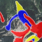
Der Lawinenkataster ist ein Verzeichnis bekannt gewordener Lawinenereignisse. Die eingetragenen Lawinenstriche geben den Kenntnisstand über niedergegangene Lawinen in ihrer größten bekannten Ausdehnung wieder, soweit von diesen Lawinen eine Gefahr für Gebäude, Bergbahnen und Skilifte sowie Verkehrswege, Skipisten und Rodelbahnen ausging oder ausgeht. Lawinenstriche abseits gefährdeter Objekte sind in der Regel nicht eingetragen. Der Lawinenkataster darf ohne weiterführende Fachbeurteilungen nicht zur Ausscheidung von Gefahrenzonen herangezogen werden. Durchgeführte Schutz- und Verbauungsmaßnahmen haben keinen Einfluss auf die Dokumentation der Lawinenstriche im Lawinenkataster. Maximale Bildgröße: 4096 x 4096 Pixel.
|
|
Citation proposal
(2014) . Lawinenkataster - WMS. http://gdk-inspire-1.ffm.gdi-de.org/geonetwork/srv/api/records/0711e8d5-ca37-4d06-b1e7-4d9c8b2c713b |
- Identification
- Distribution
- Quality
- Spatial rep.
- Ref. system
- Content
- Portrayal
- Metadata
- Md. constraints
- Md. maintenance
- Schema info
Identification
Identification info
Service Identification (19119)
Citation
- Alternate title
- Wasser
- Date ( Publication )
- 2014-03-25T00:00:00.000+01:00
- Date ( Revision )
- 2020-01-20T00:00:00.000+01:00
- Status
- On going
Point of contact
- Website
- https://www.lfu.bayern.de
Distributor
- Website
- https://www.lfu.bayern.de
Maintenance information
- Maintenance and update frequency
- As needed
- Update scope
- Service
- GEMET - INSPIRE themes, version 1.0 ( Theme )
-
- Gebiete mit naturbedingten Risiken
- Service Classification, version 1.0 ( Theme )
-
- infoMapAccessService
- Keywords
-
- gdiby
- Spatial scope
- Keywords
-
- inspireidentifiziert
- Use limitation
- keine Einschränkungen
Legal constraints
- Use constraints
- Other restrictions
- Other constraints
- Creative Commons Namensnennung - Weitergabe unter gleichen Bedingungen 4.0 International (CC BY-SA 4.0); Datenquelle: Bayerisches Landesamt für Umwelt, www.lfu.bayern.de
- Other constraints
- {"id":"cc-by-sa/4.0","name":"Creative Commons Namensnennung - Weitergabe unter gleichen Bedingungen 4.0 International (CC BY-SA 4.0)","url":"https://creativecommons.org/licenses/by-sa/4.0/deed.de","quelle":"Bayerisches Landesamt für Umwelt, www.lfu.bayern.de"}
Legal constraints
- Access constraints
- otherRestrictions Other restrictions
- Service Type
- view
- Service Version
- OGC:WMS 1.3.0
Extent
- Description
- Der Dienst umfasst den bayerischen Alpenraum.
N
S
E
W
))
Coupled Resource
- Operation Name
- GetCapabilities
Coupled Resource
- Operation Name
- GetMap
Coupled Resource
- Operation Name
- GetFeatureInfo
Coupled Resource
- Operation Name
- esri_wms:GetStyles
- Coupling Type
- Tight
Contains Operations
- Operation Name
- GetCapabilities
- Distributed Computing Platforms
- Web services
- Operation Description
- application/vnd.ogc.wms_xml; text/xml;
Contains Operations
- Operation Name
- GetMap
- Distributed Computing Platforms
- Web services
- Operation Description
- image/bmp; image/jpeg; image/tiff; image/png; image/png8; image/png24; image/png32; image/gif; image/svg+xml;
Contains Operations
- Operation Name
- GetFeatureInfo
- Distributed Computing Platforms
- Web services
- Operation Description
- application/vnd.esri.wms_raw_xml; application/vnd.esri.wms_featureinfo_xml; application/vnd.ogc.wms_xml; text/xml; text/html; text/plain;
Contains Operations
- Operation Name
- esri_wms:GetStyles
- Distributed Computing Platforms
- Web services
- Operation Description
- application/vnd.ogc.sld+xml;
- Operates On
Distribution
Distribution
- Distribution format
-
- Sonstiges ()
Distributor
Distributor
- Website
- https://www.lfu.bayern.de
- Fees
- geldleistungsfrei
- OnLine resource
-
URL des Dienstes
URL des Dienstes
- OnLine resource
-
Dienst "Lawinenkataster - WMS" (GetCapabilities)
application/vnd.ogc.wms_xml; text/xml;
Quality
Data quality
Scope
- Hierarchy level
- Service
- Other
- service
Conformance result
Citation
- Date ( Publication )
- 2013-04-04
- Explanation
- see the referenced specification
- Pass
- true
Conformance result
Citation
- Date ( Publication )
- 2009-10-20
- Explanation
- see the referenced specification
- Pass
- true
Conformance result
Citation
- Date ( Publication )
- 2010-12-07
- Explanation
- see the referenced specification
- Pass
- false
Metadata
Metadata
- File identifier
- 0711e8d5-ca37-4d06-b1e7-4d9c8b2c713b XML
- Metadata language
- German
- Character set
- UTF8
- Hierarchy level
- service Service
- Hierarchy level name
- service
- Date stamp
- 2024-06-28
- Metadata standard name
- ISO19119
- Metadata standard version
- 2005/PDAM 1
Point of contact
- Website
- https://www.lfu.bayern.de
Overviews
Provided by

Views
0711e8d5-ca37-4d06-b1e7-4d9c8b2c713b
Access to the portal
Read here the full details and access to the data.
Associated resources
Not available