 INSPIRE-1
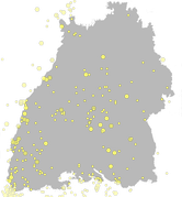
LGRB-BW INSPIRE LED: Historische Erdbeben vor 1900 (Natural Risk Zone: Observed Events) - Datensatz
Der vom Landeserdbebendienst bearbeitete historische Erdbebenkatalog beinhaltet Angaben zu Erdbeben in und um Baden-Württemberg, auf dieser Ebene vom Jahr 1000 bis 1899. Kartenmäßig dargestellt sind alle Ereignisse im Gebiet 47.3°N bis 50.0°N und 7.2°E bis 10.75°E, die mit einer gewissen Wahrscheinlichkeit als Erdbeben identifiziert werden können. Explosionen und andere Ereignisse wie Felsstürze etc. sind in dieser Darstellung nicht enthalten. Im vorinstrumentellen Zeitalter stammen die Informationen aus Berichten und Meldungen unzähliger Quellen. Nicht spürbare Erdbeben sind also per se nicht enthalten. Bei der Erstellung des Katalogs wurde auf eine Vielzahl anderer Zusammenstellungen (Kataloge) zurück gegriffen. Die entsprechende Autorenschaft oder verantwortliche Agentur wird jeweils aufgeführt.
|
|
Citation proposal
. LGRB-BW INSPIRE LED: Historische Erdbeben vor 1900 (Natural Risk Zone: Observed Events) - Datensatz. http://gdk-inspire-1.ffm.gdi-de.org/geonetwork/srv/api/records/13cdd2b9-175e-4bc9-b324-b59f63e2f130 |
INSPIRE
Identification
- File identifier
- 13cdd2b9-175e-4bc9-b324-b59f63e2f130 XML
- Hierarchy level
- Dataset
Online resource
Resource identifier
- Metadata language
- German
- Spatial representation type
- Vector
Encoding
- Format
- ESRI Shapefile
- Version
- n/a (default)
- Specification
- https://www.esri.com/content/dam/esrisites/sitecore-archive/Files/Pdfs/library/whitepapers/pdfs/shapefile.pdf
Projection
Classification of data and services
- Topic category
-
- Geoscientific information
- Environment
Classification of data and services
Coupled resource
Coupled resource
Classification of data and services
Coupled resource
Coupled resource
Keywords
- Liste der Datenkategorien in der GDI-BW für Geodaten
-
- inspireidentifiziert
- opendata
- GEMET - INSPIRE themes, version 1.0 ( Theme )
- Spatial scope
- GDI-BW-Schlüsselwortliste nach dem mehrsprachigen Umwelt-Thesaurus GEMET
-
- Geologie
- Monitoring
Other keywords
- Keywords
-
- Erdbeben
Geographic coverage
N
S
E
W
))
Temporal reference
Temporal extent
Temporal extent
- Date ( Revision )
- 2022-01-01
Quality and validity
- Lineage
- Erdbebenkatalog von Baden-Württemberg
- Denominator
- 350000
Conformity
Conformity
Conformity
Conformity
Conformity
Conformity
Restrictions on access and use
Restrictions on access and use
Responsible organization (s)
Contact for the resource
- Organisation name
- Regierungspräsidium Freiburg - Abteilung 9 Landesamt für Geologie, Rohstoffe und Bergbau, Ref. 98 Landeserdbebendienst
- abteilung9@rpf.bwl.de
Responsible organization (s)
Contact for the resource
- Organisation name
- Regierungspräsidium Freiburg - Abteilung 9 Landesamt für Geologie, Rohstoffe und Bergbau, Ref. 98 Landeserdbebendienst
- abteilung9@rpf.bwl.de
Metadata information
Contact for the metadata
- Organisation name
- Regierungspräsidium Freiburg - Abteilung 9 Landesamt für Geologie, Rohstoffe und Bergbau, Referat 91 Geowissenschaftliches Landeservicezentrum
- abteilung9@rpf.bwl.de
- Organisation name
- Regierungspräsidium Freiburg - Abteilung 9 Landesamt für Geologie, Rohstoffe und Bergbau, Referat 91 Geowissenschaftliches Landeservicezentrum
- abteilung9@rpf.bwl.de
- Date stamp
- 2025-11-18T00:06:47
- Metadata language
- German
- Character set
- UTF8
SDS
Conformance class 1: invocable
Access Point URL
Endpoint URL
Technical specification
Conformance class 2: interoperable
Coordinate reference system
Quality of Service
Access constraints
Limitation
Use constraints
Limitation
Responsible custodian
Contact for the resource
Conformance class 3: harmonized
Overviews
thumbnail
Provided by

Views
13cdd2b9-175e-4bc9-b324-b59f63e2f130
Access to the portal
Read here the full details and access to the data.
Associated resources
Not available