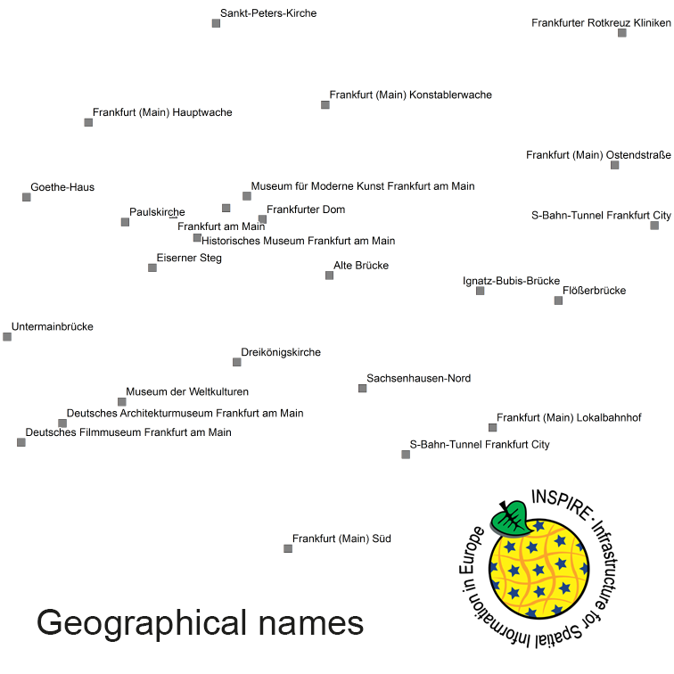
INSPIRE Geographical Names GN250
The INSPIRE-conform dataset geographical names Germany is the base for an INSPIRE-conform Web Feature Service (WFS) and Web Map Services (WMS). The dataset includes all relevant feature types from the digital landscape model scale 1:250.000 (DLM250): settlements, transportation, vegetation, hydrography, areas and regions with attributes regarding position (geometry data from DLM250), status and language of the geographical name.
|
|
Citation proposal
. INSPIRE Geographical Names GN250. http://gdk-inspire-1.ffm.gdi-de.org/geonetwork/srv/api/records/142d56bb-108b-4e6a-96a6-8239b80af77e |
INSPIRE
Identification
- File identifier
- 142d56bb-108b-4e6a-96a6-8239b80af77e XML
- Hierarchy level
- dataset Dataset
Online resource
Resource identifier
- Metadata language
- German
- Metadata language
- Sorbian languages
- Metadata language
- Upper Sorbian
- Metadata language
- Lower Sorbian
- Metadata language
- Western Frisian
- Metadata language
- Danish
- Spatial representation type
- Vector
Encoding
- Format
- GML
- Version
- 3.2
Projection
Classification of data and services
- Topic category
-
- Location
Classification of data and services
Coupled resource
Coupled resource
Classification of data and services
Coupled resource
Coupled resource
Keywords
- GEMET - INSPIRE themes, version 1.0 ( Theme )
-
- Geographical names
- GEMET - Concepts, version 3.1 ( Theme )
- Spatial scope
- High-value dataset categories
Other keywords
- Keywords
-
- names
- important buildings
- administrative units
- hydography
- settlement names
- Keywords
-
- inspireidentifiziert
- Keywords
-
- opendata
- Keywords
-
- AdVMIS
Geographic coverage
N
S
E
W
))
Temporal reference
Temporal extent
Temporal extent
- Date ( Creation )
- 2015-11-15T00:00:00.000+01:00
- Date ( Revision )
- 2021-12-31T00:00:00.000+01:00
Quality and validity
- Lineage
- Transformation from national name database into INSPIRE. Sources: Geographisches Namenbuch Bundesrepublik Deutschland, IfAG 1981, Ergänzung 1991 bis 1996 Auswahl der Namen: Übersichtskarten 1:500.000, 1:250.000, 1:25.000
- Denominator
- 300000
- Denominator
- 150000
Conformity
Conformity
Conformity
Conformity
Conformity
Conformity
- Explanation
- see the referenced specification
- Explanation
- see the referenced specification
Restrictions on access and use
- Access constraints
- The data are protected by copyright. In accordance with the "Geodatenzugangsgesetz" (Geodata Access Act), the data are made available free of charge for download and online use, see https://sgx.geodatenzentrum.de/web_public/gdz/lizenz/geozg.pdf. The use of the data is regulat-ed by the "Verordnung zur Festlegung der Nutzungsbestimmungen für die Bereitstellung von Geodaten des Bundes – GeoNutzV" (Regulation on the Determination of the Terms of Use for the Provision of Federal Geodata) of 19 March 2013 (Bundesgesetzblatt Jahrgang 2013 Teil I Nr. 14), see https://sgx.geodatenzentrum.de/web_public/gdz/lizenz/eng/geonutzv.pdf. The source note must be observed.
- Access constraints
- Quellenvermerk: © GeoBasis-DE / BKG (year of last data download)
- Access constraints
- {"id":"geoNutz/20130319","name":"Nutzungsbestimmungen für die Bereitstellung von Geodaten des Bundes","url":"https://sg.geodatenzentrum.de/web_public/gdz/lizenz/geonutzv.pdf","quelle":"© GeoBasis-DE / BKG (year of last data download)"}
Restrictions on access and use
Responsible organization (s)
Contact for the resource
- Organisation name
- Federal Agency for Cartography and Geodesy
- mailbox@bkg.bund.de
- Organisation name
- Federal Agency for Cartography and Geodesy
- dlz@bkg.bund.de
- Organisation name
- Federal Agency for Cartography and Geodesy
- dlz@bkg.bund.de
Metadata information
Contact for the metadata
- Organisation name
- Federal Agency for Cartography and Geodesy
- dlz@bkg.bund.de
- Date stamp
- 2025-11-24
- Metadata language
- English
- Character set
- UTF8
SDS
Conformance class 1: invocable
Access Point URL
Endpoint URL
Technical specification
Conformance class 2: interoperable
Coordinate reference system
Quality of Service
Access constraints
Limitation
Use constraints
Limitation
Responsible custodian
Contact for the resource
Conformance class 3: harmonized
Overviews

overview
Provided by

Views
142d56bb-108b-4e6a-96a6-8239b80af77e
Access to the portal
Read here the full details and access to the data.
Associated resources
Not available
 INSPIRE-1