 INSPIRE-1
Grundwassermessstellen
Lage der Grundwassermessstellen, die sich im Eigentum der Senatsverwaltung für Mobilität, Verkehr, Klimaschutz und Umwelt und der Berliner Wasserbetriebe befinden.
|
|
Citation proposal
. Grundwassermessstellen. http://gdk-inspire-1.ffm.gdi-de.org/geonetwork/srv/api/records/19e2079f-d700-3ada-b197-ca9b07349e5e |
- Identification
- Distribution
- Quality
- Spatial rep.
- Ref. system
- Content
- Portrayal
- Metadata
- Md. constraints
- Md. maintenance
- Schema info
Identification
Data identification
Citation
- Date ( Creation )
- 2024-03-01
Point of contact
Point of contact
Point of contact
- Maintenance and update frequency
- Fortnightly
- Keywords ( Theme )
-
- inspireidentifiziert
- open data
- opendata
- Karten
- Sachdaten
- Geodaten
- Berlin
- Grundwassermessstellen
- Grundwasser
- Messstellen
- Landesmessnetz
- Messnetz
- GEMET - INSPIRE themes, version 1.0 ( Theme )
-
- Umweltüberwachung
- Räumlicher Anwendungsbereich ( Theme )
Legal constraints
- Access constraints
- Other restrictions
Legal constraints
- Use constraints
- Other restrictions
- Other constraints
- Für die Nutzung der Daten ist die Datenlizenz Deutschland - Zero - Version 2.0 anzuwenden. Die Lizenz ist über https://www.govdata.de/dl-de/zero-2-0 abrufbar.
- Other constraints
- {"id":"dl-zero-de/2.0","name":"Datenlizenz Deutschland - Zero - Version 2.0","url":"https://www.govdata.de/dl-de/zero-2-0"}
- Spatial representation type
- Vector
- Denominator
- 5000
- Metadata language
- German
- Character set
- UTF8
- Topic category
-
- Structure
Extent
N
S
E
W
))
Geographic description
- Extent type code
- true
- Geographic identifier
- 110000000000
Distribution
Distribution
- Distribution format
-
-
Text/HTML
(4.01 )
- Specification
- Keine Angabe
-
Text/HTML
(4.01 )
- OnLine resource
-
Darstellungsdienst - Grundwassermessstellen (WMS)
Darstellungsdienst - Grundwassermessstellen (WMS)
- OnLine resource
-
Downloaddienst - Grundwassermessstellen (WFS)
Downloaddienst - Grundwassermessstellen (WFS)
- OnLine resource
-
Inhaltliche Beschreibung
Inhaltliche Beschreibung
- OnLine resource
-
Technische Beschreibung
Technische Beschreibung
Digital transfer options
- OnLine resource
-
Wasserportal Berlin
Wasserportal Berlin
- OnLine resource
-
Geologisches Auskunftsportal
Geologisches Auskunftsportal
Quality
Data quality
- Hierarchy level
- Dataset
Conformance result
Citation
- Date ( Publication )
- 2010-12-08
- Explanation
- see referenced specification
- Pass
- false
Lineage
- Statement
- Datenbank der Arbeitsgruppe Landesgeologie innerhalb der Senatsverwaltung für Mobilität, Verkehr, Klimaschutz und Umwelt
- Description
- Datenbank der Arbeitsgruppe Landesgeologie innerhalb der Senatsverwaltung für Mobilität, Verkehr, Klimaschutz und Umwelt
Ref. system
- Reference system identifier
- http://www.opengis.net/def/crs/EPSG/0/25833
Metadata
Metadata
- File identifier
- 19e2079f-d700-3ada-b197-ca9b07349e5e XML
- Metadata language
- German
- Character set
- UTF8
- Hierarchy level
- Dataset
- Date stamp
- 2025-11-19T00:00:00Z
- Metadata standard name
- ISO 19115/19119 - BE
- Metadata standard version
- 1.0.0
Point of contact
Overviews
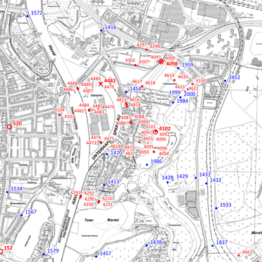
Vorschaubild
Provided by

Views
19e2079f-d700-3ada-b197-ca9b07349e5e
Access to the portal
Read here the full details and access to the data.
Associated resources
Not available