 INSPIRE-1
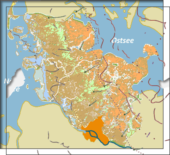
Geologische Übersichtskarte von Schleswig-Holstein 1:250.000
Die Geologische Karte 1:250.000 (GÜK 250) gibt einen Überblick über die Verbreitung, Entstehung, Zusammensetzung und das Alter der an der Erdoberfläche anstehenden Ablagerungen und erlaubt somit auch eine Abschätzung der Gesteinseigenschaften. Sie stellt eine orientierende Planungs- bzw. Informationsgrundlage im Übersichtsmaßstab dar. Die Karte repräsentiert den aktuellen Stand der geologischen Landesaufnahme in Schleswig-Holstein für die obersten 2 m. Die Karte "Geologische Übersichtskarte von Schleswig-Holstein 1:250.000" setzt sich aus den Einzlayern "Geologische Einheiten" und "Geologische Zusatzinformationen" zusammen.
|
|
Citation proposal
(2013) . Geologische Übersichtskarte von Schleswig-Holstein 1:250.000. http://gdk-inspire-1.ffm.gdi-de.org/geonetwork/srv/api/records/1c82089a-313e-4c25-9389-0b704c885401 |
INSPIRE
Identification
- File identifier
- 1c82089a-313e-4c25-9389-0b704c885401 XML
- Hierarchy level
- dataset Dataset
Online resource
Resource identifier
- Metadata language
- German
- Spatial representation type
- Vector
Encoding
- Format
- Shapefiles
Projection
Classification of data and services
- Topic category
-
- Geoscientific information
Classification of data and services
Coupled resource
Coupled resource
Classification of data and services
Coupled resource
Coupled resource
Keywords
- GEMET - INSPIRE themes, version 1.0 ( Theme )
-
- Geologie
- Spatial scope
Other keywords
- Keywords
-
- gdi-sh
- Geologische Übersichtskarte
- Geologische Einheiten
- Geologie
- Karten
- sgd_Geologie
- opendata
- Keywords ( Theme )
-
- ENVI
- Keywords
-
- inspireidentifiziert
Geographic coverage
N
S
E
W
))
Temporal reference
Temporal extent
Temporal extent
- Date ( Revision )
- 2013-06-13T00:00:00.000+02:00
- Date ( Publication )
- 2013-03-01T00:00:00.000+01:00
- Date ( Creation )
- 2014-11-25T00:00:00.000+01:00
Quality and validity
- Lineage
- Die Geologische Übersichtskarte 1:250.000 wurde als gedruckte Karte vom Landesamt für Landwirtschaft, Umwelt und ländliche Räume (LLUR) veröffentlicht. Grundlage für diese sind geologische Kartenwerke im Wesentlichen des Maßstabes 1:25.000. Wo diese nicht vorlagen, wurde auf unveröffentlichte Kartierungsergebnisse in diesem Maßstab zurück gegriffen.
- Denominator
- 250000
Conformity
Conformity
Conformity
Conformity
Conformity
Conformity
- Explanation
- see the referenced specification
Restrictions on access and use
- Access constraints
- Datenlizenz Deutschland Namensnennung 2.0
- Access constraints
- Quellenvermerk: LfU-SH
- Access constraints
- {"id":"dl-by-de/2.0","name":"Datenlizenz Deutschland Namensnennung 2.0","url":"https://www.govdata.de/dl-de/by-2-0","quelle":"LfU-SH"}
Restrictions on access and use
Responsible organization (s)
Contact for the resource
- Organisation name
- Landesamt für Umwelt des Landes Schleswig-Holstein (LfU)
Responsible organization (s)
Contact for the resource
- Organisation name
- Landesamt für Umwelt des Landes Schleswig-Holstein (LfU)
Metadata information
Contact for the metadata
- Organisation name
- Landesamt für Umwelt des Landes Schleswig-Holstein (LfU)
- jan.willer@lfu.landsh.de
- Date stamp
- 2025-08-06
- Metadata language
- German
SDS
Conformance class 1: invocable
Access Point URL
Endpoint URL
Technical specification
Conformance class 2: interoperable
Coordinate reference system
Quality of Service
Access constraints
Limitation
Use constraints
Limitation
Responsible custodian
Contact for the resource
Conformance class 3: harmonized
Overviews
Vorschaubild
Provided by

Views
1c82089a-313e-4c25-9389-0b704c885401
Access to the portal
Read here the full details and access to the data.
Associated resources
Not available