 POC 3.12
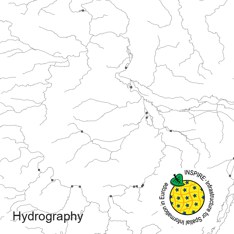
INSPIRE Hydrography ATKIS-DLM250
Hydrography of Germany, derived from the german digital landscape model at scale 1:250000. Mapped via EuroRegionalMap to satisfy INSPIRE and European Location Framework conformance. The dataset contains the hydrographic network and physical waters and is available as Open Data.
- Identification
- Distribution
- Quality
- Spatial rep.
- Ref. system
- Content
- Portrayal
- Metadata
- Md. constraints
- Md. maintenance
- Schema info
Identification
Data identification
Citation
- Alternate title
-
Digitale Landschaftsmodelle
- Date (Creation)
- 2017-09-06T00:00:00.000+02:00
- Date (Revision)
- 2018-12-31T00:00:00.000+01:00
- Identifier
- https://registry.gdi-de.org/id/de.bund.bkg.csw/DEBKG00M00000208
- Status
- On going
+49 341 5634-415
https://www.bkg.bund.de
+49 69 6333-235
https://www.bkg.bund.de
+49 341 5634-415
https://www.bkg.bund.de
Maintenance information
- Maintenance and update frequency
- Biannually
- Update scope
- Dataset
-
GEMET - INSPIRE themes, version 1.0
-
-
Hydrography
-
-
GEMET - Concepts, version 3.1
-
-
watercourse
-
- Keywords
-
-
physical waters
-
standing water
-
hydro network
-
- Keywords
-
-
inspireidentifiziert
-
- Keywords
-
-
opendata
-
- Keywords
-
-
AdVMIS
-
Legal constraints
- Access constraints
- Other restrictions
- Other constraints
- no limitations to public access
Legal constraints
- Use constraints
- Other restrictions
- Other constraints
-
This data may be used without restriction and free of charge pursuant to the Ordinance for the Establishment of the Conditions of Use regarding the Provision of Federal Spatial Data (Verordnung zur Festlegung der Nutzungsbestimmungen für die Bereitstellung von Geodaten des Bundes – GeoNutzV) as published on March 19, 2013 (Bundesgesetzblatt Jahrgang 2013 Teil I Nr. 14). For more details see: https://sg.geodatenzentrum.de/web_public/gdz/lizenz/eng/geonutzv.pdf. Please include the required reference to the source when using the data.
- Other constraints
-
Quellenvermerk: © GeoBasis-DE / BKG (year of last data download)
- Other constraints
-
{"id":"geoNutz/20130319","name":"Nutzungsbestimmungen für die Bereitstellung von Geodaten des Bundes","url":" https://sg.geodatenzentrum.de/web_public/gdz/lizenz/geonutzv.pdf","quelle":"© GeoBasis-DE / BKG (year of last data download)"}
- Spatial representation type
- Vector
- Denominator
- 250000
- Metadata language
- Deutsch
- Character set
- UTF8
- Topic category
-
- Inland waters
Extent
Geographic description
- Extent type code
- Yes
- Geographic identifier
- Bundesrepublik Deutschland (000000000000)
))
Distribution
Distribution
- Distribution format
-
-
GML
(
3.2
)
-
GML
(
3.2
)
Quality
Data quality
- Hierarchy level
- Dataset
Conformance result
Citation
- Date (Publication)
- 2010-04-26
- Explanation
-
see the referenced specification
- Pass
- Yes
Conformance result
Citation
- Date (Publication)
- 2010-12-08
- Explanation
-
see the referenced specification
- Pass
- Yes
- Statement
-
derived from german topographic database 1:250 000
Ref. system
- Unique resource identifier
- EPSG 4258: ETRS89 / geographisch
Metadata
Metadata
- File identifier
- A912C808-0B5A-4F39-A822-19C29047AE0B XML
- Metadata language
- English
- Character set
- UTF8
- Hierarchy level
- Dataset
- Date stamp
- 2023-11-22
- Metadata standard name
-
ISO19115
- Metadata standard version
-
2003/Cor.1:2006
Overviews
Spatial extent
Provided by
