 POC 3.12
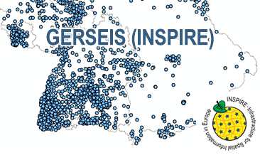
INSPIRE: German Earthquake Catalogue (WMS)
The WMS GERSEIS (INSPIRE) represents the seismological events of the German Earthquake Catalogue which is based on a database providing information on the seismicity in Germany and adjacent areas. It contains locations of seismic events since year 800 where their epicentre determinations are based on historical sources as well as on measurements at seismometer stations since the start of instrumental seismological recording in the 20th century. Today, digital data acquisition at seismometer stations of the German regional seismic network (GRSN), the seismic GERES array, and the Gräfenberg array (GRF) takes place. All events with a local magnitude ML 2.0 and higher are listed. Due to the continuous processing of the seismic events, the INSPIRE dataset is updated annually. The WMS GERSEIS (INSPIRE) contains a layer of the seismological events (NZ.ObservedEvent) displayed correspondingly to the INSPIRE portrayal rules. Via the getFeatureInfo request the user obtains the content of the INSPIRE attributes unitsOfMeasure, qualitativeValue, quantitativeValue, validFrom and intensityScale (short name of citation of the intensity scale).
Der WMS GERSEIS (INSPIRE) zeigt die seismologischen Ereignisse, die im Deutschen Erdbebenkatalog der BGR fortlaufend gespeichert werden. Dieser Katalog liefert Informationen zum seismischen Geschehen in Deutschland und benachbarten Gebieten. Er beinhaltet die Orte, an denen seit dem Jahr 800 seismische Ereignisse stattfanden. Grundlage für die Epizentrumsbestimmung sind historische Quellen sowie seit Beginn der instrumentellen Erdbebenaufzeichnung im 20. Jahrhundert Messungen mit Seismometerstationen. Die digitale Datenerfassung findet an den Seismometerstationen des Deutschen Regionalnetzes (GRSN) sowie den Messanlagen des GERES-Arrays und des Gräfenberg-Arrays (GRF) statt. Es werden alle Ereignisse mit einer lokalen Magnitude ML 2,0 oder aufgelistet. Aufgrund der kontinuierlichen Erfassung der seismischen Ereignisse wird der INSPIRE-Datensatz in jährlichem Abstand aktualisiert. Der WMS GERSEIS (INSPIRE) beinhaltet ein Layer mit den seismologischen Ereignissen (NZ.ObservedEvent), die gemäß der INSPIRE-Darstellungsregeln abgebildet sind. Mit Hilfe der getFeatureInfo-Anfrage erhält der User die Inhalte der INSPIRE-Attribute unitsOfMeasure, qualitativeValue, quantitativeValue, validFrom, intensityScale (Kurzname der Intensitätsskala aus dem Attribut citation).
Simple
Identification info
- Alternate title
-
GERSEIS (WMS) (INSPIRE)
- Date (Creation)
- 2018-07-26
- Date (Publication)
- 2018-09-18
- Identifier
- https://registry.gdi-de.org/id/de.bund.bgr.csw/a57cdf83-1a0a-479a-3807-c3ae1f38ad0d
- Status
- On going
- Theme
-
-
Seismologie
-
Epizentrum
-
Erdbeben
-
Induzierte Seismizität
-
Tektonik
-
inspireidentifiziert
-
opendata
-
infoMapAccessService
-
- Place
-
-
Germany and its EEZ
-
Deutschland und deutsche AWZ
-
-
GEMET - INSPIRE themes, version 1.0
-
-
Gebiete mit naturbedingten Risiken
-
-
GEMET - Concepts, version 2.4
-
-
Seismische Überwachung
-
-
Spatial scope
-
-
National
-
- Access constraints
- Other restrictions
- Other constraints
- Es gelten keine Zugriffsbeschränkungen
- Use constraints
- Other restrictions
- Other constraints
-
Terms of Use: General terms and conditions, see https://www.bgr.bund.de/AGB_en. For further use provided information has to be cited as follows: GERSEIS (WMS) (INSPIRE), (c) BGR, Hannover, 2018
- Other constraints
-
Dieser Datensatz kann gemäß der "Nutzungsbestimmungen für die Bereitstellung von Geodaten des Bundes" ( https://sg.geodatenzentrum.de/web_public/gdz/lizenz/geonutzv.pdf) genutzt werden.
- Service Type
- view
- Service Version
-
OGC:WMS 1.3.0
))
Coupled Resource
- Operation Name
-
GetMap
- Coupling Type
- Tight
Contains Operations
- Operation Name
-
GetCapabilities
- Distributed Computing Platforms
- Web services
- Connect Point
- https://services.bgr.de/wms/inspire_nz/gerseis/?
Contains Operations
- Operation Name
-
GetMap
- Distributed Computing Platforms
- Web services
- Connect Point
- https://services.bgr.de/wms/inspire_nz/gerseis/?
- Unique resource identifier
- EPSG:25832
- Distribution format
-
-
png
(
n/a
)
-
jpeg
(
n/a
)
-
gif
(
n/a
)
-
png
(
n/a
)
- OnLine resource
- https://services.bgr.de/wms/inspire_nz/gerseis/?REQUEST=GetCapabilities&SERVICE=wms&VERSION=1.3.0
- OnLine resource
- Karte im BGR-Geoviewer
- Hierarchy level
- Service
- Other
-
Service
Conformance result
- Date (Publication)
- 2009-10-20
- Explanation
-
See the referenced specification
Conformance result
- Date (Publication)
- 2013-04-04
- Explanation
-
See the referenced specification
- Pass
- Yes
- Statement
-
The WMS GERSEIS (INSPIRE) is based on historical descriptions of damages due to earthquakes and measured and analysed data of current earthquakes recorded by the German seismological stations transformed according to INSPIRE.
- File identifier
- a8f4f4fa-84b7-46d4-8ed2-03245362d31a XML
- Metadata language
- Deutsch
- Character set
- UTF8
- Hierarchy level
- Service
- Hierarchy level name
-
Geophysik
- Hierarchy level name
-
INSPIRE
- Date stamp
- 2020-07-14
- Metadata standard name
-
INSPIRE Metadata Implementing Rules: Technical Guidelines based on EN ISO 19115 and EN ISO 19119
- Metadata standard version
-
n/a
Overviews
Spatial extent
Provided by
