 INSPIRE-1
ATKIS® DGM - Digitales Geländemodell -
Das ATKIS DGM ist ein Teil des Amtlichen Topographisch-Kartographischen Informationssystem (ATKIS). Das DGM beschreibt höhenmäßig die Erdoberfläche ohne natürliche (z. B. Vegetation) und künstliche Objekte (z. B. Bauwerke). Das DGM liegt in Form eines gleichmäßigen Rasters mit einer Rasterweite von 1m im Blattschnitt 2km x 2km vor. In das Land Brandenburg reicht ein Buffer von ca. 250m.
|
|
Citation proposal
. ATKIS® DGM - Digitales Geländemodell -. http://gdk-inspire-1.ffm.gdi-de.org/geonetwork/srv/api/records/b0485f06-a39e-3cc2-b5e0-be7fcd425dab |
INSPIRE
Identification
- File identifier
- b0485f06-a39e-3cc2-b5e0-be7fcd425dab XML
- Hierarchy level
- Service
Online resource
Resource identifier
Encoding
- Format
- Text/HTML
- Version
- 4.01
Projection
Classification of data and services
Classification of data and services
- Service Type
- view
- Coupling Type
- Tight
Coupled resource
Coupled resource
Classification of data and services
- Service Type
- view
- Coupling Type
- Tight
Coupled resource
Coupled resource
Keywords
Other keywords
- Keywords ( Theme )
-
- inspireidentifiziert
- open data
- opendata
- AdVMIS
- Geodaten
- Berlin
- DGM
- ATKIS
- Topographie
- Topografie
- topographisch
- topografisch
- Höhenmodell
- Höhenmodelle
- Höhenlinien
- Geländemodell
- Geländemodelle
- Gelände
- Keywords
-
- infoMapAccessService
Geographic coverage
N
S
E
W
))
Temporal reference
Temporal extent
Temporal extent
- Date ( Creation )
- 2021-07-13
- Date ( Revision )
- 2023-12-22
Quality and validity
Conformity
Conformity
Conformity
Conformity
Conformity
Conformity
Restrictions on access and use
Restrictions on access and use
- Access constraints
- Für die Nutzung der Daten ist die Datenlizenz Deutschland - Namensnennung - Version 2.0 anzuwenden. Die Lizenz ist über https://www.govdata.de/dl-de/by-2-0 abrufbar. Der Quellenvermerk gemäß (2) der Lizenz lautet "Geoportal Berlin / [Titel des Datensatzes]".
- Access constraints
- { "id": "dl-by-de/2.0" , "name": "Datenlizenz Deutschland - Namensnennung - Version 2.0", "url": "https://www.govdata.de/dl-de/by-2-0", "quelle": "Geoportal Berlin / [Titel des Datensatzes]" }
Responsible organization (s)
Contact for the resource
- Organisation name
- Senatsverwaltung für Stadtentwicklung, Bauen und Wohnen Berlin
- Organisation name
- Senatsverwaltung für Stadtentwicklung, Bauen und Wohnen Berlin
Responsible organization (s)
Contact for the resource
- Organisation name
- Senatsverwaltung für Stadtentwicklung, Bauen und Wohnen Berlin
- Organisation name
- Senatsverwaltung für Stadtentwicklung, Bauen und Wohnen Berlin
Metadata information
Contact for the metadata
- Organisation name
- Senatsverwaltung für Stadtentwicklung, Bauen und Wohnen Berlin
- Date stamp
- 2024-07-31T11:54:10
- Metadata language
- German
SDS
Conformance class 1: invocable
- Pass
- true
Access Point URL
Endpoint URL
Technical specification
- Date
- Explanation
- see referenced specification
Conformance class 2: interoperable
Coordinate reference system
Quality of Service
Access constraints
- Access constraints
- Other restrictions
Limitation
Use constraints
Limitation
- string
- Für die Nutzung der Daten ist die Datenlizenz Deutschland - Namensnennung - Version 2.0 anzuwenden. Die Lizenz ist über https://www.govdata.de/dl-de/by-2-0 abrufbar. Der Quellenvermerk gemäß (2) der Lizenz lautet "Geoportal Berlin / [Titel des Datensatzes]".
- string
- { "id": "dl-by-de/2.0" , "name": "Datenlizenz Deutschland - Namensnennung - Version 2.0", "url": "https://www.govdata.de/dl-de/by-2-0", "quelle": "Geoportal Berlin / [Titel des Datensatzes]" }
Responsible custodian
Contact for the resource
Conformance class 3: harmonized
Contains Operations
- Operation Name
- GetCapabilities
- Distributed Computing Platforms
- Web services
- Connect Point
- https://gdi.berlin.de/services/wms/dgm1
Overviews
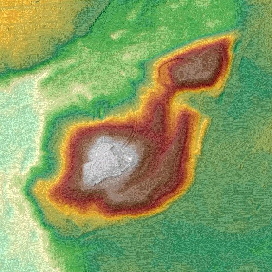
Vorschaugrafik

Legende
Provided by

Views
b0485f06-a39e-3cc2-b5e0-be7fcd425dab
Access to the portal
Read here the full details and access to the data.
Associated resources
Not available