 POC 3.12
Landesmessnetze Grundwasser und Quellen - Downloaddienst
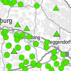
Der Downloaddienst Landesmessnetze stellt die Lage von Messstellen der Landesmessnetze Grundwasser und Quellen als Shapefile zum Download bereit. Der Landesgrundwasserdienst-quantitativ hat die Aufgabe, für staatliche Planungs- und Überwachungstätigkeiten und zur Weitergabe an nichtstaatliche Stellen Daten über Grundwasserstände und Quellschüttungen aller überregional bedeutenden Grundwasserleiter kontinuierlich zu sammeln, aufzubereiten und bereitzustellen.
INSPIRE
Identification
- File identifier
- b2ef27f3-e32a-469d-bad0-d340571818db XML
- Hierarchy level
- Service
Online resource
Resource identifier
Encoding
- Format
-
Shapefile (*.shp)
- Version
-
keine Angabe
Classification of data and services
- Service Type
- download
- Coupling Type
- Tight
Coupled resource
Coupled resource
Classification of data and services
- Service Type
- download
- Coupling Type
- Tight
Coupled resource
Coupled resource
Keywords
-
Spatial scope
-
-
Regional
-
Other keywords
- Theme
-
-
Quellen
-
Grundwasserstand
-
- Keywords
-
-
gdiby
-
inspireidentifiziert
-
- Keywords
-
-
infoFeatureAccessService
-
Geographic coverage
))
Temporal reference
Temporal extent
Temporal extent
- Date (Publication)
- 2014-05-19
Conformity
Conformity
Conformity
Conformity
Conformity
Conformity
- Explanation
-
Der Dienst erfüllt die funktionalen und qualitativen Anforderungen.
Restrictions on access and use
- Use limitation
-
keine Einschränkungen
- Access constraints
-
Der Datensatz/Dienst steht unter der Lizenz: Creative Commons Namensnennung - Weitergabe unter gleichen Bedingungen 4.0 International (CC BY-SA 4.0). Die Namensnennung des Bayerischen Landesamtes für Umwelt als Rechteinhaber hat in folgender Weise zu erfolgen: "Datenquelle: Bayerisches Landesamt für Umwelt, www.lfu.bayern.de".
- Access constraints
-
{ "id": "cc-by-sa", "name": "Creative Commons Namensnennung - Weitergabe unter gleichen Bedingungen (CC BY-SA)", "quelle": "Datenquelle: Bayerisches Landesamt für Umwelt, www.lfu.bayern.de", "url": " http://creativecommons.org/licenses/by-sa/3.0/deed.de" }
- Access constraints
- Es gelten keine Zugriffsbeschränkungen
Responsible organization (s)
Contact for the resource
- Organisation name
-
Bayerisches Landesamt für Umwelt
-
datenstelle@lfu.bayern.de datenstelle@lfu.bay datenstelle@lfu.bayern.de
Responsible organization (s)
Contact for the resource
- Organisation name
-
Bayerisches Landesamt für Umwelt
-
datenstelle@lfu.bayern.de datenstelle@lfu.bay datenstelle@lfu.bayern.de
Metadata information
Contact for the metadata
- Organisation name
-
Bayerisches Landesamt für Umwelt
-
datenstelle@lfu.bayern.de datenstelle@lfu.bay datenstelle@lfu.bayern.de
- Date stamp
- 2022-10-26T06:59:36+01:00
- Metadata language
- Deutsch
SDS
Conformance class 1: invocable
- Pass
- Yes
- Pass
- Yes
- Pass
- No
Access Point URL
Endpoint URL
Technical specification
- Date
- Explanation
-
Der Dienst erfüllt die funktionalen und qualitativen Anforderungen.
- Date
- Explanation
-
Getestet mit der GDI-DE Testsuite.
- Date
- Explanation
-
Datenmodelltransformation noch nicht durchgeführt.
Conformance class 2: interoperable
Access constraints
- Access constraints
- Other restrictions
- Other constraints
- Es gelten keine Zugriffsbeschränkungen
Limitation
Use constraints
Limitation
- string
-
Der Datensatz/Dienst steht unter der Lizenz: Creative Commons Namensnennung - Weitergabe unter gleichen Bedingungen 4.0 International (CC BY-SA 4.0). Die Namensnennung des Bayerischen Landesamtes für Umwelt als Rechteinhaber hat in folgender Weise zu erfolgen: "Datenquelle: Bayerisches Landesamt für Umwelt, www.lfu.bayern.de".
- string
-
{ "id": "cc-by-sa", "name": "Creative Commons Namensnennung - Weitergabe unter gleichen Bedingungen (CC BY-SA)", "quelle": "Datenquelle: Bayerisches Landesamt für Umwelt, www.lfu.bayern.de", "url": " http://creativecommons.org/licenses/by-sa/3.0/deed.de" }
Responsible custodian
Contact for the resource
Conformance class 3: harmonized
Contains Operations
- Operation Name
-
GetDownloadServiceMetadata
- Distributed Computing Platforms
- Web services
- Operation Description
-
application/vnd.ogc.wms_xml; text/xml;
Contains Operations
- Operation Name
-
DescribeSpatialDataset
- Distributed Computing Platforms
- Web services
- Operation Description
-
image/bmp; image/jpeg; image/tiff; image/png; image/png8; image/png24; image/png32; image/gif; image/svg+xml;
Contains Operations
- Operation Name
-
GetSpatialDataset
- Distributed Computing Platforms
- Web services
- Operation Description
-
application/vnd.esri.wms_raw_xml; application/vnd.esri.wms_featureinfo_xml; application/vnd.ogc.wms_xml; text/xml; text/html; text/plain;
Overviews
Spatial extent
Provided by
