 INSPIRE-1
Arten_Biotopschutz - ABSP-Schutzvorschlag
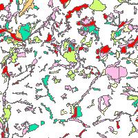
Der Kartendienst stellt Daten aus dem Arten- und Biotopschutzprogramm des Saarlandes dar.:Arten- und Biotopschutzprogramm Saarland - Schutzvorschlag - schützenswerte Flächen unterteilt in Prioritätsstufen von örtlicher bis bundesweiter Bedeutung (GESABEW: 1 - Örtliche Bedeutung, 2 - Überörtliche Bedeutung, 3 - Regionale Bedeutung, 4 - Landesweite Bedeutung, 5 - Bundesweite Bedeutung, 9 Entwicklungsflächen)
|
|
Citation proposal
. Arten_Biotopschutz - ABSP-Schutzvorschlag. Ministerium für Umwelt, Klima, Mobilität, Agrar und Verbraucherschutz http://gdk-inspire-1.ffm.gdi-de.org/geonetwork/srv/api/records/e3ab6796-80ab-de33-ae30-4340cd41f8c6 |
Simple
Identification info
- Alternate title
- Date ( Revision )
- 2024-11-05
- Keywords
-
- Naturschutz
- Artenschutz
- ABSP
- opendata
- opendata
- infoMapAccessService
- inspireidentifiziert
- Access constraints
- Other restrictions
- Use constraints
- Other restrictions
- Other constraints
- Lizenz: cc-by-4.0 - Namensnennung 4.0 International - https://creativecommons.org/licenses/by/4.0/deed.de - Quellenvermerk: © GDI-SL (Jahr)
- Other constraints
- {"id":"cc-by-4.0","name":"Namensnennung 4.0 International","url":"https://creativecommons.org/licenses/by/4.0/deed.de","quelle":"© GDI-SL (Jahr)"}
- Service Type
- view
- Service Version
- OGC:WMS 1.1.1
N
S
E
W
))
- Coupling Type
- Tight
Contains Operations
- Operation Name
- GetCapabilities
- Distributed Computing Platforms
- Web services
- Distribution format
-
- ()
- OnLine resource
-
ABSP_Schutzvorschlag
Arten- und Biotopschutzprogramm Saarland - Schutzvorschlag - schützenswerte Flächen unterteilt in Prioritätsstufen von örtlicher bis bundesweiter Bedeutung (GESABEW: 1 - Örtliche Bedeutung, 2 - Überörtliche Bedeutung, 3 - Regionale Bedeutung, 4 - Landesweite Bedeutung, 5 - Bundesweite Bedeutung, 9 Entwicklungsflächen)
- Hierarchy level
- service Service
- Other
- Dienst
Conformance result
- Date ( Publication )
- 2010-12-08
- Explanation
- No explanation available
- Pass
- true
Conformance result
- Date ( Publication )
- 2009-10-20
- Explanation
- No explanation available
- Pass
- true
Conformance result
- Date ( Publication )
- 2014-12-11
- Explanation
- No explanation available
- Pass
- true
Conformance result
- Date ( Publication )
- 2008-12-04
- Explanation
- No explanation available
- Pass
- true
Conformance result
- Date ( Publication )
- 2014-12-11
- Explanation
- No explanation available
- Pass
- true
Conformance result
- Date ( Publication )
- 2013-12-10
- Explanation
- No explanation available
- Pass
- true
Conformance result
- Date ( Publication )
- 2011-02-05
- Explanation
- No explanation available
- Pass
- true
Conformance result
- Date ( Publication )
- 2010-12-08
- Explanation
- No explanation available
- Pass
- true
gmd:MD_Metadata
- File identifier
- e3ab6796-80ab-de33-ae30-4340cd41f8c6 XML
- Metadata language
- ger German
- Character set
- UTF8
- Hierarchy level
- service Service
- Hierarchy level name
- Darstellungsdienst
- Date stamp
- 2024-11-05
- Metadata standard name
- ISO19119
- Metadata standard version
- 2005/PDAM 1
Point of contact
Overviews
Thumbnail
Provided by

Views
e3ab6796-80ab-de33-ae30-4340cd41f8c6
Access to the portal
Read here the full details and access to the data.
Associated resources
Not available