 INSPIRE-1
Flurabstand des Grundwassers 2020 (Umweltatlas)
Tiefe des Grundwassers unter der Geländeoberfläche - Flurabstand, in maßstabsabhängiger Genauigkeit, differenziert, Flurabstand bei niedrigen Grundwasserständen
|
|
Citation proposal
(2023) . Flurabstand des Grundwassers 2020 (Umweltatlas). http://gdk-inspire-1.ffm.gdi-de.org/geonetwork/srv/api/records/68a2e251-ec7a-411d-a631-5fd6fa575e1d |
Simple
- Date ( Creation )
- 2023-04-15
- Date ( Publication )
- 2023-07-05
Point of contact
Point of contact
- Maintenance and update frequency
- Not planned
- Keywords ( Theme )
-
- inspireidentifiziert
- open data
- opendata
- Sachdaten
- Karten
- Geodaten
- Berlin
- Flurabstand
- Geologie
- Grundwasserstand
- Umweltatlas
- GEMET - INSPIRE themes, version 1.0 ( Theme )
-
- Geologie
- Räumlicher Anwendungsbereich ( Theme )
- Access constraints
- Other restrictions
- Use constraints
- Other restrictions
- Other constraints
- Für die Nutzung der Daten ist die Datenlizenz Deutschland - Zero - Version 2.0 anzuwenden. Die Lizenz ist über https://www.govdata.de/dl-de/zero-2-0 abrufbar.
- Other constraints
- {"id":"dl-zero-de/2.0","name":"Datenlizenz Deutschland - Zero - Version 2.0","url":"https://www.govdata.de/dl-de/zero-2-0"}
- Spatial representation type
- Vector
- Spatial representation type
- Grid
- Spatial representation type
- Text, table
- Denominator
- 50000
- Metadata language
- German
- Character set
- UTF8
- Topic category
-
- Geoscientific information
N
S
E
W
))
- Extent type code
- true
- Geographic identifier
- 110000000000
- Reference system identifier
- http://www.opengis.net/def/crs/EPSG/0/25833
- Distribution format
-
-
Text/HTML
(4.01 )
- Specification
- Keine Angabe
-
Text/HTML
(4.01 )
- OnLine resource
-
Downloaddienst - Flurabstand des Grundwassers 2020 (Umweltatlas) (ATOM)
Downloaddienst - Flurabstand des Grundwassers 2020 (Umweltatlas) (ATOM)
- OnLine resource
-
Darstellungsdienst - Flurabstand des Grundwassers 2020 (Umweltatlas) (WMS)
Darstellungsdienst - Flurabstand des Grundwassers 2020 (Umweltatlas) (WMS)
- OnLine resource
-
Downloaddienst - Flurabstand des Grundwassers 2020 (Umweltatlas) (WFS)
Downloaddienst - Flurabstand des Grundwassers 2020 (Umweltatlas) (WFS)
- OnLine resource
-
Inhaltliche Beschreibung
Inhaltliche Beschreibung
- OnLine resource
-
Technische Beschreibung
Technische Beschreibung
- OnLine resource
-
Umweltatlas, Karte 02.07
Umweltatlas, Karte 02.07
- Hierarchy level
- Dataset
Conformance result
- Date ( Publication )
- 2010-12-08
- Explanation
- see referenced specification
- Pass
- false
- Statement
- - Digitales Geländemodell DGM 1 (SenSBW, III C 1), - Grundwassergleichen Karte Mai 2020, - Bohrungsdaten des Archivs der Landesgeologie Berlin, - Digitales Geländemodell DGM 1, Stand 13.7.2021, - Grundwassergleichen (Umweltatlaskarte), Stand 05.2020
- Description
- - Digitales Geländemodell DGM 1 (SenSBW, III C 1)
- Description
- - Grundwassergleichen Karte Mai 2020
- Description
- - Bohrungsdaten des Archivs der Landesgeologie Berlin
- Description
- - Digitales Geländemodell DGM 1, Stand 13.7.2021
- Description
- - Grundwassergleichen (Umweltatlaskarte), Stand 05.2020
gmd:MD_Metadata
- File identifier
- 68a2e251-ec7a-411d-a631-5fd6fa575e1d XML
- Metadata language
- German
- Character set
- UTF8
- Hierarchy level
- Dataset
- Date stamp
- 2025-11-19T00:00:00Z
- Metadata standard name
- ISO 19115/19119 - BE
- Metadata standard version
- 1.0.0
Point of contact
Overviews
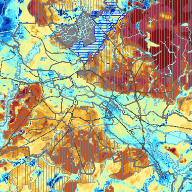
Vorschaubild
Provided by

Views
68a2e251-ec7a-411d-a631-5fd6fa575e1d
Access to the portal
Read here the full details and access to the data.
Associated resources
Not available