Keyword
Natural risk zones
33 record(s)
Provided by
Type of resources
Available actions
Keywords
Contact for the resource
Update frequencies
Service types
-

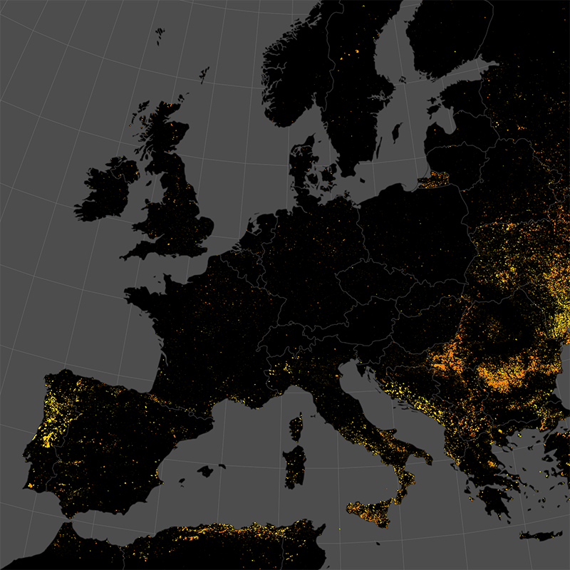
This data set represents the monthly, accumulated results of the final (10-day) version of the fire perimeters from the "Burnt Area Daily NRT Incremental Product - Europe, Sentinel-3" dataset. The burn perimeters are spatially and temporally correlated, so that interrelated detections from consecutive observations are combined into a single feature. A perimeter is interpreted as belonging to a given event if a spatial overlap exists within a time frame of 15 days. Besides the geometry, attribute information is also combined while considering the size of the perimeter as a weighting factor. Each feature contains information about the final fire perimeter, Date/Time of the first detection, and the averaged burn severity.
-

The product is automatically derived from Sentinel-3 (OLCI) satellite imagery in near-real time. It is an incremental product, meaning that the retrieved results are updated as soon as new input data becomes available over a timespan of ten days. Besides the fire perimeter, and detection time each feature contains information about the severity of the burning.
-

The product is automatically derived from Aqua/Terra (MODIS) satellite imagery in near-real time. It is an incremental product, meaning that the retrieved results are updated as soon as new input data becomes available over a timespan of ten days. Besides the fire perimeter and detection time, each feature contains information about the severity of the burning.
-

This data set represents the yearly, accumulated results of the final (10-day) version of the fire perimeters from the "Burnt Area Daily NRT Incremental Product - Europe, Sentinel-3" dataset. The burn perimeters are spatially and temporally correlated, so that interrelated detections from consecutive observations are combined into a single feature. A perimeter is interpreted as belonging to a given event if a spatial overlap exists within a time frame of 15 days. Besides the geometry, attribute information is also combined while considering the size of the perimeter as a weighting factor. Each feature contains information about the final fire perimeter, Date/Time of the first detection, and the averaged burn severity
-

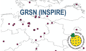
The WMS GRSN (INSPIRE) represents the seismological stations of the German Regional Seismic Network (GRSN) equipped with 3-component broadband seismometer and digital data aquisition system. The recorded data are directly transmitted to the data center at BGR in Hannover and made available to the public near realtime. According to the Data Specification on Geology (D2.8.II.4_v3.0, subtopic Geophysics) the information with respect to the seismological stations is INSPIRE-compliant. The WMS GRSN (INSPIRE) contains a layer of the seismological stations (GE.seismologicalStation) displayed correspondingly to the INSPIRE portrayal rules. Via the getFeatureInfo request the user obtains the content of the INSPIRE attributes platformType, relatedNetwork, stationType und stationRank.
-
Überflutungsflächen bei Hochwasser in Hessen: Bezeichung nach Wasserhaushaltsgesetz (WHG) §74 und nach WHG §76 (bzw. §45 Hessisches Wassergesetz (HWG)).:Überflutungsflächen eines Hochwassers mit hoher Wahrscheinlichkeit in Hessen (Bezeichnung nach Wasserhaushaltsgesetz (WHG) §74): Überflutungsflächen mit einem voraussichtlichen Wiederkehrintervall von mindestens 10 Jahren (entspricht einem 10-jährlichen Hochwasser, HQ10). Einzelne Gebiete haben auch eine abweichende Jährlichkeit für das Hochwasser mit hoher Wahrscheinlichkeit. Teil des Datenbestands der Hochwasserrisikomanagementpläne (HWRMP) in Hessen.
-
Dieser INSPIRE-Downloaddienst stellt Daten geologisch bedingter Gefährdungspotenziale des Untergrundes in Nordrhein-Westfalen bereit (GDU-Bürgerversion). Aus datenschutzrechtlichen Gründen werden die Informationen nicht grundstücksbezogen, sondern mithilfe von schematisch angeordneten Symbolen, anonymisiert in jeweils 0,5 x 0,5 Kilometer großen Rasterflächen dargestellt. Der Datensatz ist für das INSPIRE-Thema Natural Risk Zones aufbereitet und enthält zusätzlich die Raster-Planquadrate.
-
Überflutungsflächen bei Hochwasser in Hessen: Bezeichung nach Wasserhaushaltsgesetz (WHG) §74 und nach WHG §76 (bzw. §45 Hessisches Wassergesetz (HWG)).:Überflutungsflächen eines Hochwassers mit mittlerer Wahrscheinlichkeit in Hessen (Bezeichnung nach Wasserhaushaltsgesetz (WHG) §74): Überflutungsflächen mit einem voraussichtlichen Wiederkehrintervall von 100 Jahren (entspricht einem 100-jährlichen Hochwasser, HQ100). Teil des Datenbestands der Hochwasserrisikomanagementpläne (HWRMP) in Hessen.
-
Überflutungsflächen bei Hochwasser in Hessen: Bezeichung nach Wasserhaushaltsgesetz (WHG) §74 und nach WHG §76 (bzw. §45 Hessisches Wassergesetz (HWG)).:Abflussgebiete an großen Gewässern in Hessen bei einem 100-jährlichen Hochwasserereignis (HQ100), d.h. ausgewählte Bereiche innerhalb der gesetzlichen Überschwemmungsgebiete bei den Gewässern I. und II. Ordnung. Weitere Details siehe Datensatz-Metadaten.
 INSPIRE-1