 INSPIRE-1
Type
dataset
119362 record(s)
Provided by
Type of resources
Available actions
Topics
Keywords
Contact for the resource
Update frequencies
From
1
-
10
/
119362
-

Statistical units of Germany, derived from the german digital landscape model at scale 1:250000. Mapped via EuroBoundaryMap to satisfy INSPIRE conformance. The dataset is available as Open Data.
-
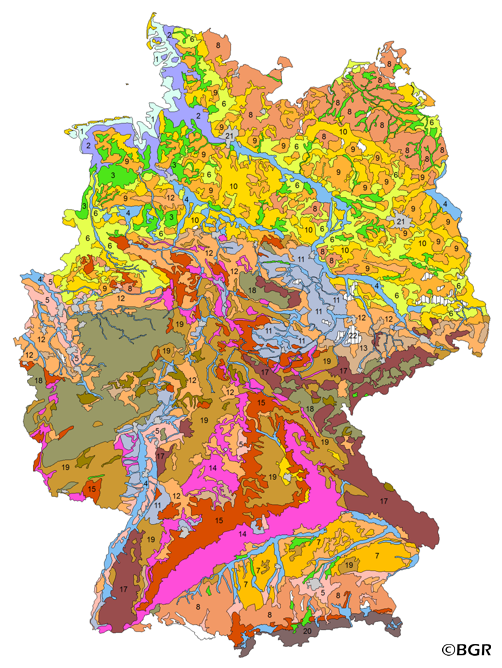
The BUEK5000 is derived form the landuse stratified soil map of Germany at scale 1:1,000,000 by aggregation, focused on information about the parent material, and generalization. The maps shows 20 soil (23) legend units with polygons of at least 64 square kilometers.
-
-
-
-
-
-
-
-