 INSPIRE-1
Keyword
Perm
15 record(s)
Provided by
Type of resources
Available actions
Topics
Keywords
Contact for the resource
Update frequencies
Service types
-
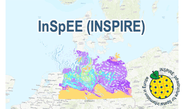
InSpEE (INSPIRE) provides information about the areal distribution of salt structures (salt domes and salt pillows) in Northern Germany. Contours of the salt structures can be displayed at horizontal cross-sections at four different depths up to a maximum depth of 2000 m below NN. The geodata have resulted from a BMWi-funded research project “InSpEE” running from the year 2012 to 2015. The acronym stands for "Information system salt structures: planning basis, selection criteria and estimation of the potential for the construction of salt caverns for the storage of renewable energies (hydrogen and compressed air)”. Additionally four horizontal cross-section maps display the stratigraphical situation at a given depth. In concurrence of maps at different depths areal bedding conditions can be determined, e.g. to generally assess and interpret the spread of different stratigraphic units. Clearly visible are extent and shape of the salt structures within their regional context at the different depths, with extent and boundary of the salt structures having been the main focus of the project. Four horizontal cross-section maps covering the whole onshore area of Northern Germany have been developed at a scale of 1:500.000. The maps cover the depths of -500, -1000, -1500, -2000 m below NN. The four depths are based on typical depth requirements of existing salt caverns in Northern Germany, mainly related to hydrocarbon storage. The shapes of the structures show rudimentary information of their geometry and their change with depths. In addition they form the starting point for rock mechanical calculations necessary for the planning and construction of salt caverns for storage as well as for assessing storage potentials. The maps can be used as a pre-selection tool for subsurface uses. It can also be used to assess coverage and extension of salt structures. Offshore areas were not treated within the project. All horizontal cross-section maps were adjusted with the respective state geological survey organisations. According to the Data Specification on Geology (D2.8.II.4_v3.0) the content of InSpEE (INSPIRE) is stored in 15 INSPIRE-compliant GML files: InSpEE_GeologicUnit_Salt_structure_types.gml contains the salt structure types (salt domes and salt pillows), InSpEE_GeologicUnit_Salt_pillow_remnants.gml comprises the salt pillow remnants, InSpEE_GeologicUnit_Structure_building_salinar.gml represents the structural salinar(s), the four files InSpEE_Structural_outlines_500.gml, InSpEE_Structural_outlines_1000.gml, InSpEE_Structural_outlines_1500.gml and InSpEE_Structural_outlines_2000.gml represent the structural outlines in the corresponding horizontal cross-sections, the four files InSpEE_GeologicUnit_Cross_Section_500, InSpEE_GeologicUnit_Cross_Section_1000, InSpEE_GeologicUnit_Cross_Section_1500 and InSpEE_GeologicUnit_Cross_Section_2000 display the stratigraphical situation in the corresponding horizontal cross-sections and the four files InSpEE_GeologicStructure_500.gml, InSpEE_GeologicStructure_1000.gml, InSpEE_GeologicStructure_1500.gml and InSpEE_GeologicStructure_2000.gml comprise the relevant fault traces in the corresponding horizontal cross-sections. The GML files together with a Readme.txt file are provided in ZIP format (InSpEE-INSPIRE.zip). The Readme.text file (German/English) contains detailed information on the GML files content. Data transformation was proceeded by using the INSPIRE Solution Pack for FME according to the INSPIRE requirements.
-
The WMS InSpEE (INSPIRE) provides information about the areal distribution of salt structures (salt domes and salt pillows) in Northern Germany. Contours of the salt structures can be displayed at horizontal cross-sections at four different depths up to a maximum depth of 2000 m below NN. The geodata have resulted from a BMWi-funded research project “InSpEE” running from the year 2012 to 2015. The acronym stands for "Information system salt structures: planning basis, selection criteria and estimation of the potential for the construction of salt caverns for the storage of renewable energies (hydrogen and compressed air)”. Taking into account the fact that this work was undertaken at a scale for providing an overview and not for investigation of single structures, the scale of display is limited to a minimum of 1:300.000. Additionally four horizontal cross-section maps display the stratigraphical situation at a given depth. In concurrence of maps at different depths areal bedding conditions can be determined, e.g. to generally assess and interpret the spread of different stratigraphic units. Clearly visible are extent and shape of the salt structures within their regional context at the different depths, with extent and boundary of the salt structures having been the main focus of the project. Four horizontal cross-section maps covering the whole onshore area of Northern Germany have been developed at a scale of 1:500.000. The maps cover the depths of -500, -1000, -1500, -2000 m below NN. The four depths are based on typical depth requirements of existing salt caverns in Northern Germany, mainly related to hydrocarbon storage. The shapes of the structures show rudimentary information of their geometry and their change with depths. In addition they form the starting point for rock mechanical calculations necessary for the planning and construction of salt caverns for storage as well as for assessing storage potentials. The maps can be used as a pre-selection tool for subsurface uses. It can also be used to assess coverage and extension of salt structures. Offshore areas were not treated within the project. All horizontal cross-section maps were adjusted with the respective state geological survey organisations. According to the Data Specification on Geology (D2.8.II.4_v3.0) the WMS InSpEE (INSPIRE) provides INSPIRE-compliant data. The WMS InSpEE (INSPIRE) contains two group layers: The first group layer “INSPIRE: Salt structures in Northern Germany“ comprises the layers GE.Geologic.Unit.Salt structure types, GE.GeologicUnit.Salt pillow remnants, GE.GeologicUnit.Structure-building salinar and GE.GeologicUnit.Structural outlines. The layer GE.GeologicUnit.Structural outlines contains according to the four depths four sublayers, e.g. GE.GeologiUnit.Structural outlines 500 m below NN. The second group layer „INSPIRE: Horizontal cross-section maps of Northern Germany“ comprises according to the four depths four layers, e.g. Horizontal cross-section map – 500 m below NN. This layer, in turns, contains two sublayers: GE.GeologicFault.Relevant fault traces and GE.GeologicUnit.Stratigraphic Units. Via the getFeatureInfo request the user obtains additional information on the different geometries. In case of the GE.Geologic.Unit.Salt structure types the user gets access to a data sheet with additional information and further reading in German for the respective salt structure via the getFeatureInfo request.
-
The map series General Geological Map of the Federal Republic of Germany 1:200,000 (GÜK200) is the result of cooperation between the State Geological Surveys of the Federal Republic of Germany (SGD), the Geological Surveys of neighbouring countries and the Federal Institute for Geosciences and Natural Resources (BGR). The GÜK200 displays the surface geology of Germany and adjacent areas of neighbouring countries on 55 map sheets. The map sheets show the regional dissemination of more than 3800 geological units. The geological units contain information on stratigraphy (age), genesis and petrography (composition) of the rocks.
-

Der Datensatz beinhaltet Informationen zur Geologie im Freistaat Sachsen. Der Datensatz des Kartenwerkes bildet die geologischen Fest- und Lockergesteinseinheiten in der Region Erzgebirge/Vogtland im Maßstab 1 : 50.000 ab. Lückenhafte Angaben zu Stratigraphie und/oder Petrographie einzelner Flächen werden schrittweise vervollständigt. Eine einheitlich graue Signatur markiert die unvollständig attributierten Features. Der Datensatz ist nutzbar in einem Maßstab kleiner als 1 : 25.000. Das Kartenwerk ist eines von 7 geologischen Kartenwerken, welches für das Gebiet des Freistaates Sachsen in jeweils eigenen Kartendiensten INSPIRE-konform bereitgestellt wird.
-

Der Downloaddienst stellt Informationen zur Geologie im Freistaat Sachsen bereit. Er übermittelt die geologischen Festgesteinseinheiten ohne Darstellung des Känozoikum in der grenzüberschreitenden Region Lausitz-Jizera-Karkonosze im Maßstab 1 : 100.000. Bei dem bereitgestellten Datensatz handelt es sich um einen Ausschnitt aus der Gesamtkarte. Die INSPIRE-konforme Umsetzung der weiteren Kartenbereiche ist derzeit in Arbeit. Lückenhafte Angaben zu Stratigraphie und/oder Petrographie einzelner Flächen werden schrittweise vervollständigt. Das Kartenwerk ist eines von 7 geologischen Kartenwerken, welches für das Gebiet des Freistaates Sachsen in jeweils eigenen Kartendiensten INSPIRE-konform bereitgestellt wird.
-

Der Darstellungsdienst präsentiert Informationen zur Geologie im Freistaat Sachsen. Er stellt die sachsenweit anstehenden geologischen Fest- und Lockergesteinseinheiten im Maßstab 1 : 400.000 in den drei einzelnen Karten "Oberfläche", "Quartär abgedeckt" und "Känozoikum abgedeckt" dar. Bei dem bereitgestellten Kartendienst handelt es sich um die Karte "Oberfläche". Die INSPIRE-konforme Umsetzung der weiteren Karten ist derzeit in Arbeit. Lückenhafte Angaben zu Stratigraphie und/oder Petrographie einzelner Flächen werden schrittweise vervollständigt. Eine einheitlich graue Signatur markiert die unvollständig attributierten Features. Der Kartendienst ist nutzbar in einem Maßstab kleiner als 1 : 50.000 sowie in verschiedenen Attributdarstellungen. Das Kartenwerk ist eines von 7 geologischen Kartenwerken, welches für das Gebiet des Freistaates Sachsen in jeweils eigenen Kartendiensten INSPIRE-konform bereitgestellt wird.
-

Der Downloaddienst stellt Informationen zur Geologie im Freistaat Sachsen bereit. Er übermittelt die geologischen Fest- und Lockergesteinseinheiten im Maßstab 1 : 25.000 unterteilt in Quartär und Präquartär. Bei dem bereitgestellten Datensatz handelt es sich um einen Ausschnitt aus der Gesamtkarte. Die INSPIRE-konforme Umsetzung der weiteren Kartenbereiche ist derzeit in Arbeit. Lückenhafte Angaben zu Stratigraphie und/oder Petrographie einzelner Flächen werden schrittweise vervollständigt. Das Kartenwerk ist eines von 7 geologischen Kartenwerken, welches für das Gebiet des Freistaates Sachsen in jeweils eigenen Kartendiensten INSPIRE-konform bereitgestellt wird.
-
Der Darstellungsdienst präsentiert Informationen zur Geologie im Freistaat Sachsen. Er stellt die geologischen Fest- und Lockergesteinseinheiten im Maßstab 1 : 25.000 unterteilt in Quartär und Präquartär dar. Bei dem bereitgestellten Kartendienst handelt es sich um einen Ausschnitt aus der Gesamtkarte. Die INSPIRE-konforme Umsetzung der weiteren Kartenbereiche ist derzeit in Arbeit. Lückenhafte Angaben zu Stratigraphie und/oder Petrographie einzelner Flächen werden schrittweise vervollständigt. Eine einheitlich graue Signatur markiert die unvollständig attributierten Features. Der Kartendienst ist nutzbar in einem Maßstab kleiner als 1 : 10.000 sowie in verschiedenen Attributdarstellungen. Das Kartenwerk ist eines von 7 geologischen Kartenwerken, welches für das Gebiet des Freistaates Sachsen in jeweils eigenen Kartendiensten INSPIRE-konform bereitgestellt wird.
-
Der Datensatz beinhaltet Informationen zur Geologie im Freistaat Sachsen. Der Datensatz des Kartenwerkes bildet den Komplex der Lausitzer Antiklinalzone und des Jizera-Karkonosze-Blockes ohne känozoische Sedimente im Maßstab 1 : 100.000 ab. Bei dem bereitgestellten Datensatz handelt es sich um einen Ausschnitt aus der Gesamtkarte. Die INSPIRE-konforme Umsetzung der weiteren Kartenbereiche ist derzeit in Arbeit. Lückenhafte Angaben zu Stratigraphie und/oder Petrographie einzelner Flächen werden schrittweise vervollständigt. Eine einheitlich graue Signatur markiert die unvollständig attributierten Features. Der Datensatz ist nutzbar in einem Maßstab kleiner als 1 : 50.000. Das Kartenwerk ist eines von 7 geologischen Kartenwerken, welches für das Gebiet des Freistaates Sachsen in jeweils eigenen Kartendiensten INSPIRE-konform bereitgestellt wird.
-
Der Datensatz beinhaltet Informationen zur Geologie im Freistaat Sachsen. Der Datensatz des Kartenwerkes bildet die geologischen Fest- und Lockergesteinseinheiten im Maßstab 1 : 25.000 ab. Bei dem bereitgestellten Datensatz handelt es sich um einen Ausschnitt aus der Gesamtkarte. Die INSPIRE-konforme Umsetzung der weiteren Kartenbereiche ist derzeit in Arbeit. Lückenhafte Angaben zu Stratigraphie und/oder Petrographie einzelner Flächen werden schrittweise vervollständigt. Eine einheitlich graue Signatur markiert die unvollständig attributierten Features. Der Datensatz ist nutzbar in einem Maßstab kleiner als 1 : 10.000. Das Kartenwerk ist eines von 7 geologischen Kartenwerken, welches für das Gebiet des Freistaates Sachsen in jeweils eigenen Kartendiensten INSPIRE-konform bereitgestellt wird.