Keyword
Meeresgeologie
5 record(s)
Provided by
Type of resources
Available actions
Topics
Keywords
Contact for the resource
Update frequencies
Service types
-

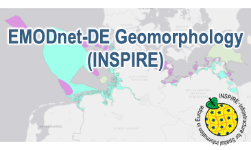
Compilation of the European marine geomorphology (section of Germany). According to the Data Specification on Geology (D2.8.II.4_v3.0) the geological map provides INSPIRE-compliant data. The WMS EMODnet-DE Geomorphology (INSPIRE) contains layers of the natural geomorphologic features (GE.GeomorphologicFeature) displayed correspondingly to the INSPIRE portrayal rules. Via the getFeatureInfo request the user obtains detailed information on the natural geomorphologic features.
-

Compilation of the European marine geomorphology (section of Germany). According to the Data Specification on Geology (D2.8.II.4_v3.0) the content of the geological map is stored in an INSPIRE-compliant GML file: EMODnet-DE_Geomorphology_NaturalGeomorphologicFeature.gml contains the natural geomorphologic features. The GML file together with a Readme.txt file are provided in ZIP format (EMODnet-DE_Geomorphology-INSPIRE.zip). The Readme.text file (German/English) contains detailed information on the GML file content. Data transformation was proceeded by using the INSPIRE Solution Pack for FME according to the INSPIRE requirements.
-
.png)
The WMS MSSP-EEZ (INSPIRE) represents marine seismic survey profiles for the German EEZ. During the period from 1996 to 2007 five cruises operated by BGR acquired seismic lines from the German EEZ. The aim of these cruises was a detailed survey of the geological structure of the seabed from the North Sea and Baltic Sea. According to the Data Specification on Geology (D2.8.II.4_v3.0, subtopic Geophysics) the content of the information with respect to the seismic profiles is INSPIRE-compliant. The WMS MSSP-EEZ (INSPIRE) contains for each cruise one layer, e.g. GE.seismicLine.pq2. The expeditions are displayed correspondingly to the INSPIRE portrayal rules. Via the getFeatureInfo request the user obtains the content of the INSPIRE attributes platformType und profileType. Additionally, the WMS contains a campaign layer (GE.2DSeismicSurvey) with the INSPIRE attributes campaignType and surveyType.
-
.png)
During the period from 1996 to 2007 five cruises operated by BGR acquired seismic lines from the German EEZ. The aim of these expeditions was a detailed survey of the geological structure of the seabed from the North Sea and Baltic Sea. The five GML files (for each cruise one) together with a Readme.txt file are provided in ZIP format (MSSP-EEZ-INSPIRE.zip). The Readme.text file (German/English) contains detailed information on the GML files content. Data transformation was proceeded by using the INSPIRE Solution Pack for FME according to the INSPIRE requirements.
-

Definition: Der morphologische Raum ist der Betrag der Differenz zwischen maximaler und minimaler Höhe eines Ortes über den Verlauf mehrerer Zeitschritte. Er kann genutzt werden, um morphologisch stabile Bereiche zu identifizieren, die zum Beispiel als potentielle Gebiete für Bauprojekte in Betracht kommen. Datenerzeugung: Die Basis für bathymetrische Produkte bilden gerasterte bathymetrische Modelle, die mithilfe des Funktionalen Bodenmodells, einem datenbasierten hindcast-Simulationsmodell, über räumlich-zeitliche Interpolationsverfahren aus einer Datenbasis von See- und Landvermessungen verschiedenster Datentypen erstellt werden. Für jedes Jahr von 1996 bis inklusive 2016 wird ein gerastertes bathymetrisches Modell in 10 m Auflösung für die Deutsche Bucht und zusätzlich in 250 m Auflösung für die Ausschließliche Wirtschaftszone für das Jahr 1996 erstellt. Für die Deutsche Bucht wird der morphologische Raum für jeden Rasterknoten berechnet, indem aus den bathymetrischen Modellen der jeweils höchste und niedrigste z-Wert über 21 Jahre Betrachtungsraum ermittelt und die Differenz zmax-zmin gebildet wird. Die maximale Spannweite der Gewässerbodenhöhe wird an jedem Punkt dargestellt. Da es sich um eine Auswertung mehrerer Zeitschritte handelt, ist der morphologische Raum nicht für die Ausschließliche Wirtschaftszone ermittelbar. Produkt: 10 m Raster der Deutschen Bucht, wobei an jedem Rasterknoten der Betrag des morphologischen Raums über den Zeitraum 1996 bis 2016 abgelegt ist. Das Produkt wird im GeoTiff-Format bereitgestellt. Zitat für diesen Datensatz (Daten DOI): Sievers, J., Rubel, M., Milbradt, P. (2020): EasyGSH-DB: Themengebiet - Geomorphologie. Bundesanstalt für Wasserbau. https://doi.org/10.48437/02.2020.K2.7000.0001 Literatur: Sievers, J., Milbradt, P., Ihde, R., Valerius, J., Hagen, R., Plüß, A. (2021): An integrated marine data collection for the German Bight – Part 1: Subaqueous geomorphology and surface sedimentology (1996–2016). Earth System Science Data. https://doi.org/10.5194/essd-13-4053-2021 English Download: The data for download can be found under References ("Weitere Verweise"), where the data can be downloaded directly or via the web page redirection to the EasyGSH-DB portal.
 INSPIRE-1