 INSPIRE-1
Keyword
Gebiete mit naturbedingten Risiken
234 record(s)
Provided by
Type of resources
Available actions
Topics
Keywords
Contact for the resource
Update frequencies
Service types
-
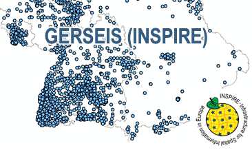
The WMS GERSEIS (INSPIRE) represents the seismological events of the German Earthquake Catalogue which is based on a database providing information on the seismicity in Germany and adjacent areas. It contains locations of seismic events since year 800 where their epicentre determinations are based on historical sources as well as on measurements at seismometer stations since the start of instrumental seismological recording in the 20th century. Today, digital data acquisition at seismometer stations of the German regional seismic network (GRSN), the seismic GERES array, and the Gräfenberg array (GRF) takes place. All events with a local magnitude ML 2.0 and higher are listed. Due to the continuous processing of the seismic events, the INSPIRE dataset is updated annually. The WMS GERSEIS (INSPIRE) contains a layer of the seismological events (NZ.ObservedEvent) displayed correspondingly to the INSPIRE portrayal rules. Via the getFeatureInfo request the user obtains the content of the INSPIRE attributes unitsOfMeasure, qualitativeValue, quantitativeValue, validFrom and intensityScale (short name of citation of the intensity scale).
-
The German Earthquake Catalogue is based on a database providing information on the seismicity in Germany an adjacent areas. It contains locations of seismic events since year 800 where their epicentre determinations are based on historical sources as well as on measurements at seismometer stations since the start of instrumental seismological recording in the 20th century. Today, digital data acquisition at seismometer stations of the German regional seismic network (GRSN), the seismic GERES array, and the Gräfenberg array (GRF) takes place. All events with a local magnitude ML 2.0 and higher are listed. The GML file together with a Readme.txt file are provided in ZIP format (GERSEIS-INSPIRE.zip). The Readme.text file (German/English) contains detailed information on the GML file content. Data transformation was proceeded by using the INSPIRE Solution Pack for FME according to the INSPIRE requirements. Due to the continuous processing of the seismic events, the INSPIRE dataset is updated annually.
-

The WMS GRSN (INSPIRE) represents the seismological stations of the German Regional Seismic Network (GRSN) equipped with 3-component broadband seismometer and digital data aquisition system. The recorded data are directly transmitted to the data center at BGR in Hannover and made available to the public near realtime. According to the Data Specification on Geology (D2.8.II.4_v3.0, subtopic Geophysics) the information with respect to the seismological stations is INSPIRE-compliant. The WMS GRSN (INSPIRE) contains a layer of the seismological stations (GE.seismologicalStation) displayed correspondingly to the INSPIRE portrayal rules. Via the getFeatureInfo request the user obtains the content of the INSPIRE attributes platformType, relatedNetwork, stationType und stationRank.
-
Dieser Datensatz stellt den Radweg der K 121 Stralendorf nach Lanken und Lanken nach Rom dar.
-
Dieser Downloaddienst stellt Daten zum INSPIRE-Thema Gebiete mit naturbedingten Risiken in der Freien Hansestadt Bremen (FHB) bereit.
-
Für den vorbeugenden Hochwasserschutz sind Gebiete und Räume, die bei Hochwasser überschwemmt und die für Hochwasserrückhaltung beansprucht werden, als Überschwemmungsgebiete festgesetzt und gesetzlich geschützt. Die wesentlichen Verbote der Bebauung und der Bodenaufbringung in Überschwemmungsgebieten sollen die Gefahren bei Hochwasser verringern und die Funktion der Hochwasserrückhaltung nachhaltig gewährleisten. Eigentümer von Flächen in Überschwemmungsgebieten können sich gerne über weitere Verbote aber auch Genehmigungsmöglichkeiten von Vorhaben auf ihren Flächen erkundigen. Im Landkreis Oldenburg bestehen bisher 9 Überschwemmungsgebiete: Überschwemmungsgebiet des Bümmersteder Fleths Hochwasserrückhaltebecken der Delme Überschwemmungsgebiet der Delme von Holzkamp bis Harpstedt Überschwemmungsgebiet der Delme von Harpstedt bis zur Kreisgrenze Überschwemmungsgebiet des Dünsener Baches Überschwemmungsgebiet der Hunte unterhalb der Stadt Oldenburg Überschwemmungsgebiet der Hunte von Goldenstedt bis Höven Überschwemmungsgebiet des Klosterbachs Überschwemmungsgebiet der Lethe Überschwemmungsgebiet des Randgrabens mit Polder Weitere Überschwemmungsgebiete sind für die Berne mit Kimmer Bäke, die Heidkruger Bäke und die Welse vorgesehen.
-
Downloaddienst zu den Waldbrandgefahrenklassen im Land Brandenburg
-
Flächen der aktuellen festgesetzten und der vorläufig gesicherten Überschwemmungsgebiete im Landkreis Hildesheim. Als Überschwemmungsgebiet sind die Gebiete festgesetzt, in denen ein Hochwasserereignis statistisch einmal in 100 Jahren zu erwarten ist. Überschwemmungsgebiete werden durch die Untere Wasserbehörde per Verordnung festgesetzt. Die Gebiete die noch nicht durch Verordnung festgesetzt sind wurden durch den NLWKN vorläufig gesichert.
-
Dieser Dienst stellt für das Annex-III-Thema Gebiete mit naturbedingten Risiken, hier die gesetzlichen Überschwemmungsgebiete der Fließgewässer Hamel, Hastebach, Humme, Mainbach, Remte und Weser im Gebiet der Stadt Hameln dar.
-
Gesetzlich festgesetzte Überschwemmungsgebiete im Landkreis Schaumburg