 INSPIRE-1
Keyword
Schleswig-Holstein
117 record(s)
Provided by
Type of resources
Available actions
Topics
Keywords
Contact for the resource
Update frequencies
Service types
-
.png)
The WMS D-AERO (INSPIRE) comprises airborne geophysical surveys for mapping the shallow subsurface in Germany. Since the eighties BGR carries out helicopter borne measurements in Germany as well as in neighbouring and distant countries. In particular a series of continuous areas on the German North Sea coast are flown during the last years within the context of the D-AERO project. The helicopter of type Sikorsky S-76B is operated for the airborne geophysical survey of the earth's subsurface. Usually airborne electromagnetic, magnetic and radiometric measurements are carried out. According to the Data Specification on Geology (D2.8.II.4_v3.0, sub-theme Geophysics) the information with respect to the airborne geophysical surveys is INSPIRE-compliant. The WMS D-AERO (INSPIRE) contains for each airborne geophysical survey one layer, e.g. GE.flightLine.G081Cuxhaven. The flightlines are displayed correspondingly to the INSPIRE portrayal rules. Via the getFeatureInfo request, the user obtains the content of the INSPIRE attributes platformType und profileType. Additionally, the WMS contains a campaign layer (GE.airborneGeophysicalSurvey) with the INSPIRE attributes campaignType and surveyType.
-
Since the eighties BGR carries out helicopter borne measurements in Germany as well as in neighbouring and distant countries. In particular a series of continuous areas on the German North Sea coast are flown during the last years within the context of the D-AERO project. The helicopter of type Sikorsky S-76B is operated for the airborne geophysical survey of the earth's subsurface. Usually airborne electromagnetic, magnetic and radiometric measurements are carried out. The 13 GML files for each airborne geophysical survey area together with a Readme.txt file are provided in ZIP format (D-AERO-INSPIRE.zip). The Readme.text file (German/English) contains detailed information on the GML files content. Data transformation was proceeded by using the INSPIRE Solution Pack for FME according to the INSPIRE requirements of data specification Geology (D2.8.II.4_v3.0), Sub-theme Geophysics.
-
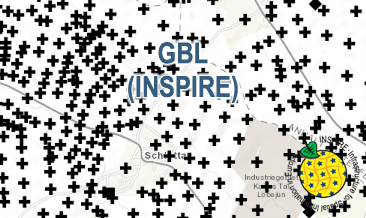
The GBL (INSPIRE) represents mechanically drilled boreholes approved by the State Geological Surveys of Germany (SGS). Most of the drilling data were not collected by the SGS, but were transmitted to SGS by third parties in accordance with legal requirements. Therefore, the SGS can accept no responsibility for the accuracy of the information. According to the Data Specification on Geology (D2.8.II.4_v3.0) the boreholes of each federal state are stored in one INSPIRE-compliant GML file. The GML file together with a Readme.txt file is provided in ZIP format (e.g. GBL-INSPIRE_Lower_Saxony. zip). The Readme.txt file (German/English) contains detailed information on the GML file content. Data transformation was proceeded by using the INSPIRE Solution Pack for FME according to the INSPIRE requirements.
-
Darstellung der Landschaftsschutzgebiete im Kreis Ostholstein (GLB)
-
Darstelltung der Geschützten Landschaftsbestandteile im Kreis Ostholstein (GLB)
-

INSPIRE-Darstellungsdienst zum Annex1-Thema Verkehrsnetze für das Bundesland Schleswig-Holstein. Die geometrischen Informationen können innerhalb des Maßstabsbereich von 1:1 bis 1:12.000.000, in den angebotenen Referenzsystemen, visualisiert werden.
-
Der Datensatz für das INSPIRE Thema Annex 1 Gewässernetz Hydro - Physische Gewässer wurde aus dem ALKIS nach der INSPIRE Produktspezifikation der AdV abgeleitet.
-
Der Datensatz für das INSPIRE Thema Annex 1 Verkehrsnetze wurde aus dem Datenbestand des Landesbetrieb Straßenbau und Verkehr (LBV) abgeleitet.
-
Dieser Dienst stellt für das INSPIRE-Thema Geplante Bodennutzung (planned land use) umgesetzte Daten der Bebauungspläne (B-Plan) bereit.
-

Dieser Datensatz umfasst die Raumordnungsplanung Schleswig-Holstein in Vektorform (thematische Inhalte des Landesentwicklungsplan Schleswig-Holstein - Fortschreibung 2021 und thematische Inhalte der bestehenden Regionalpläne I-V Schleswig-Holstein)